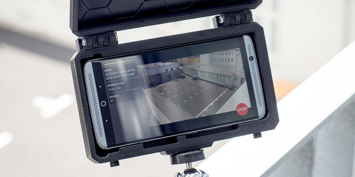
Place the phone on a street or plaza
Grab an inexpensive Android smartphone and find an elevated spot like a balcony or a window. All occurences of pedestrians, cyclists and other objects in view of the camera are detected. The phone can record for a few minutes or up to several hours hours.
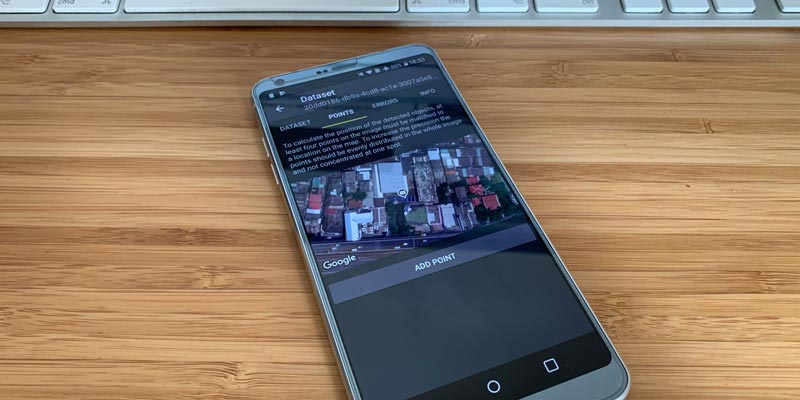
Postprocess directly on the phone
Add afterwards a match between image points and spots on a map and the gathered data will be converted to map coordinates.
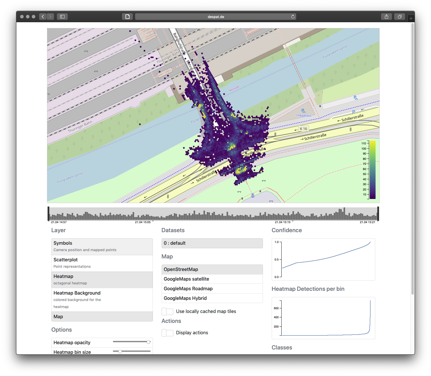
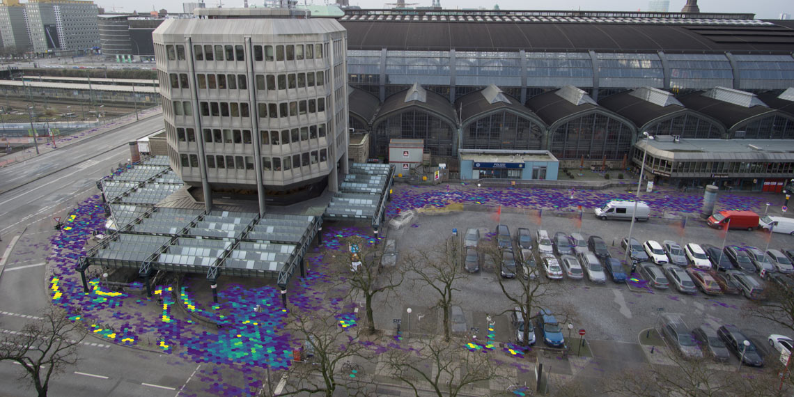
Analyze and visualize datasets on an interactive map
Recorded data can be exported and analyzed conventiently on an interactive map in a browser.
Filtering by object class (pedestrian, bicycle, car, ...) and time is easy. Data is visualized as an heatmap or scatterplot.